http://students.uwf.edu/mlp27/intro%20GIS/Final%20Project/FPL%20Bobwhite-Manatee.pptx
http://students.uwf.edu/mlp27/intro%20GIS/Final%20Project/FPL%20Bobwhite.pdf
Wednesday, April 28, 2010
Saturday, April 10, 2010
Module 11 : Labels and Spatial Analyst
Item 1: Cities and Roads from 'Mamage your Labels with Class'
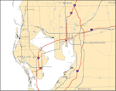 This exercise was a good supplement to the Cartography class's section on labels and annotation. I'm surprised that it did not cover the 'Change labels to annotation' function.
Item 2: Recreation from 'Add Custom Text to your Maps'
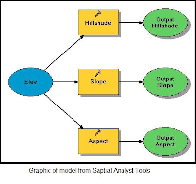
The model graphic seems to be a basic flow chart, providing a visual representation of the process.
Item 4: Reclassed vegetation map from 'Reclassify your Data to Common Scale'
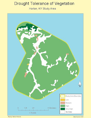 After I completed the reclassification, I changed the colors to accentuate the diffeent areas of tolerance and changed the legend labels to meaningful words as opposed to numbers.
 This exercise was a good supplement to the Cartography class's section on labels and annotation. I'm surprised that it did not cover the 'Change labels to annotation' function.
Item 2: Recreation from 'Add Custom Text to your Maps'
 The ability to use the spline labels and call-outs will be very handy in future assignments.
Item 3: Screen snapshot of model graphic from 'Working with Spatial analyst Tools'

The model graphic seems to be a basic flow chart, providing a visual representation of the process.
Item 4: Reclassed vegetation map from 'Reclassify your Data to Common Scale'
 After I completed the reclassification, I changed the colors to accentuate the diffeent areas of tolerance and changed the legend labels to meaningful words as opposed to numbers.
Friday, April 9, 2010
Module 9: Raw Data and Tables

I accidently deleted this post while reviewing the blog in preparation for the week 11 work. Fortunately I had an extra saved copy of the map.
I had a difficult time finding the right file to download on the DOR website. There were several tables and only one included the combination of Parcel ID and Owner's name. From there, doing the Smmary and selecting the four largest landowners was fairly easy. I created a new layer and defined the four different colors to the property owners.
Subscribe to:
Comments (Atom)